Connecting landscapes, farm-level economic decisions, air quality, and water quality is part of discovering how diversified agricultural systems can succeed. Making those connections is one of the challenges the DCB Modeling Team is tackling.
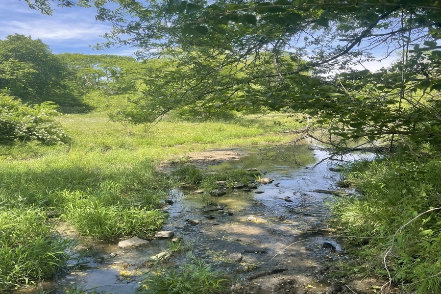
Monitoring water quality starts with the In-Field Team, which includes Keith Schilling, state geologist of Iowa and director of the Iowa Geological Survey. The In-Field Team placed 26 monitoring wells in a variety of Iowa, Illinois, and Indiana farm settings, including corn, soybeans, horticulture, miscanthus, and agroforestry. Groundwater samples are regularly drawn from the wells.
“We’re measuring high-resolution water table fluctuations, sampling them on a regular basis, and using that information to see how well precipitation recharge is getting through the diverse landscape covers to impact groundwater,” Schilling says.
Applications for Diversified Systems
So far, Schilling says, the water sampling results from the In-Field Team look promising to Schilling.
“We’re seeing big differences in pairing these systems up around different locations in the Midwest where you do see very big differences in water table behavior, even in close proximity to each other, largely due to the overlying cover,” Schilling says.
The Modeling Team creates mathematical or numerical experiments known as ecohydrological modeling—using land use, soil, climate, and other input data, including results from the field-site measurements—to understand the effects of on-field or cropping practices, such as cover crops, corn and soybean rotations, or pasture, on surface water and groundwater quality.
Tassia Mattos Brighenti is an environmental engineer who worked on her postdoc at Iowa State University. Her work includes ecohydrological modeling for the Des Moines River Basin. She says hydrology refers to the path of water.
“Hydrology is where the water is going after it rains,” Mattos Brighenti says. “The hydrology itself does not deal with just climate and clouds. The ecohydrological model is putting all these equations together and finding ways to link them between each other until we have the answer of the final path of the water.”
Modeling Team member Phil Gassman is an environmental scientist who has worked at Iowa State University’s Center for Agricultural and Rural Development for nearly 40 years. He focuses on environmental modeling with the Soil & Water Assessment Tool (SWAT), an open-source ecohydrological model with a worldwide user community.
SWAT can duplicate the water cycle, both on land and in waterways, and it can be used for watersheds or river basins. The software can be used to create scenarios based on measurements of current conditions, as well as develop solutions for water resource problems.
“SWAT can be and has been used anywhere from field research plots up to entire continents,” Gassman says.
Schilling says watershed-scale scenarios are an important part of hydrological research.
“There’s no way to sample runoff from a single farm,” Schilling says. “If you’re measuring runoff or stream flow from an area, it’s draining a watershed or a basin. Farms are organized largely on squares and rectangles, so you don’t get a single farm representing the entire drainage area.”
Gassman agrees that it’s difficult to conduct an on-farm, large-scale study to analyze subjects such as nutrient loads on waterways. He sees concern about nutrient, sediment, and pesticide movement from the soil into creeks and rivers.
“If you develop an ecohydrological model, you could analyze different solutions for reducing the loads,” Gassman says. “You can’t do that in the real world because you can’t get that level of cooperation. You can’t do it in a big enough scale.”
Mattos Brighenti says climate can be taken into account in the models, as well, so that future temperature and precipitation changes can be analyzed as to how they will affect the farming landscape.
Gassman says SWAT contributes helpful insights to on-the-ground soil sampling or groundwater monitoring results. Schilling adds that the In-Field Team is still analyzing how all of their work with soil, water, weeds, and insects intersects.
“There is a lot of overlap,” Schilling says. “We’re still trying to figure out exactly how water table fluctuations impact insects. So, there’s some of those connections that we haven’t quite figured out, but the soil and the water are pretty well connected.”
Gassman says economics are the trickiest part of combining the models.
“If you can’t build an infrastructure and provide economic benefit to the people producing the crops or the livestock product, producers or the people who own the land aren’t going to go there,” Gassman says.
For more information on ecohydrological modeling and the work of Mattos Brighenti and Gassman, see Comparison of Two Tile-Drain Methods in SWAT via Temporal and Spatial Testing for an Iowa Watershed.
To see more from the In-Field Team, check out “Insects, Weeds, and Crop Productivity: Entomological Research of the DCB In-Field Team,” and “The Dimensions of Soil Health: Measuring Soil Properties in the Field.”

